Fishing Books & Charts
Fishing Books & Charts
- Product
- Qty in Cart
- Quantity
- Price
- Subtotal
-

Fishing The Massachusetts Coast by John Gribb
$16.95The coastal waters of Massachusetts and Cape Cod offer some of the finest saltwater fishing in the United States, attracting legions of anglers in pursuit of striped bass, bluefish, fluke and other species. Here is a thorough, detailed guide to fishing...- SKU:
- 25940
- short-description:
- FISHING THE MASS COAST, GRIBB
- optionTitle:
- 1580801196
- Style:
- ANG1580801196
- Model:
- 1580801196
$16.95 -

The Classic Streamer Fly Box by Mike Valla
$20.99Streamers, and hair wing versions called bucktails, are versatile patterns that can be fished anywhere whether targeting landlocked salmon on a pristine Rangeley region Maine lake, largemouth bass swimming among the lily pads in a tepid southern farm...- SKU:
- 100616859
- short-description:
- THE CLASSIC STREAMER FLY BOX
- optionTitle:
- 738781
- Style:
- GLB0811738781
- Model:
- 738781
$20.99 -

Favorite Flies for Maine: 50 Essential Patterns from Local Experts by Bob Mallard
$23.99Maine angling expert, Bob Mallard, showcases flies that work well on Maine waters and pays tribute to the region he knows so well. Though not a tying manual, each fly is featured in a spread that includes a large, easy-to-see image, recipe and tying...- SKU:
- 100615991
- short-description:
- FAVORITE FLIES FOR MAINE MALLARD
- optionTitle:
- 0811770040
- Style:
- GLB0811770040
- Model:
- 0811770040
$23.99 -

Maptech Decorative Nautical Chart - Portland Harbor ME
$44.95Display your favorite harbor in your home or office! Just peel the backing off and apply directly to your wall, door, window, or any smooth surface. It's easy to peel off and reapply, is low tack, and does not leave any residue. Displays Portland Maine...- SKU:
- 100018300
- short-description:
- DECORATIVE NAUTICAL PORTLAND ME
- optionTitle:
- D-PORME
- Style:
- EATD-PORME
- Model:
- D-PORME
$44.95 -

Maptech Decorative Nautical Chart - Portsmouth NH & Kittery ME
$44.95Display your favorite harbor in your home or office! Just peel the backing off and apply directly to your wall, door, window, or any smooth surface. It's easy to peel off and reapply, is low tack, and does not leave any residue. Displays Portsmouth NH /...- SKU:
- 100018299
- short-description:
- DECORATIVE NAUT PORTS KITTERY ME NH
- optionTitle:
- D-POR
- Style:
- EATD-POR
- Model:
- D-POR
$44.95 -

Captain Segull's Small Boat / Kayak: Saco Bay, ME Sportfishing Chart
$11.99Captain Segull's Small Boat / Kayak Charts highlight latitude and longitude (GPS), Loran lines, contour lines, shore services such as fuel docks, loading ramps, kayak launches, pump-out stations and restaurants. Also shown are fishing holes with local...- SKU:
- 100000647
- short-description:
- SACO BAY ME
- optionTitle:
- SC0387
- Style:
- CAPSC0387
- Model:
- SC0387
$11.99 -

Captain Segull's Small Boat / Kayak: Portland, ME Sportfishing Chart
$11.99Captain Segull's Small Boat / Kayak Charts highlight latitude and longitude (GPS), Loran lines, contour lines, shore services such as fuel docks, loading ramps, kayak launches, pump-out stations and restaurants. Also shown are fishing holes with local...- SKU:
- 100000646
- short-description:
- PORTLAND ME
- optionTitle:
- PTL388
- Style:
- CAPPTL388
- Model:
- PTL388
$11.99 -

Maptech Folding Waterproof Chart - Massachusetts Bay and Boston Harbor
$29.95Maptech's® flip-fold charts are printed on a tough waterproof paper that will not tear when the wind hits it as you look for the next spot to fish. No matter how good your electronics are, viewing a large area in detail is best done with a chart. Prudent...- SKU:
- 1008576
- short-description:
- MASS BAY BOSTON HARBOR
- optionTitle:
- WPC021
- Style:
- EATWPC021
- Model:
- WPC021
$29.95 -
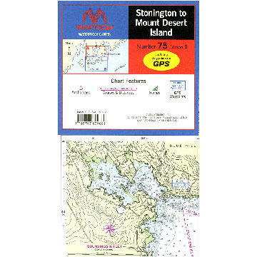
Maptech Stonington to Mount Desert Island Waterproof Chart
$29.95This chart covers the myriad islands, harbors, and passages from Eggemoggin Reach and Eastern Penobscot Bay to Bar Harbor. Maptech® waterproof charts are a big improvement over large, cumbersome charts. Spread a chart out to its full width, or keep it...- SKU:
- 95708
- short-description:
- STONINGTON TO MT DESERT WP CHART
- optionTitle:
- WPC075
- Style:
- EATWPC075
- Model:
- WPC075
$29.95 -

Northern Forest Canoe Trail #11: Moosehead / Penobscot Region - Moosehead Lake to Umbazooksus Stream
$12.95The 740-mile water trail links the watersheds of northern New York, Vermont, Quebec, New Hampshire, and Maine, following Native American travel routes through the rivers of this region. Moosehead Lake is largest lake in Maine-Thoreau traveled this...- SKU:
- 68617
- short-description:
- NO.FRST CANOE TRL MOOSEHEAD SEC.11
- optionTitle:
- 994-3
- Style:
- MTN994-3
- Model:
- 994-3
$12.95 -

National Geographic Allagash Wilderness Waterway North Map
$14.95The Allagash Wilderness Waterway is a majestic 92-mile-long ribbon of rivers, lakes, ponds, and streams that winds its way through the heart of the North Maine Woods. National Geographic's Trails Illustrated map of Allagash Wilderness Waterway North is...- SKU:
- 62926
- short-description:
- ALLAGASH WILDERNESS WATERWAY NORTH3
- optionTitle:
- 400
- Style:
- WFP400
- Model:
- 400
$14.95 -

Captain Segull's Small Boat / Kayak: Merrimack River, Plum Island Sound, Massachusetts Nautical Sportfishing Chart
$11.99Captain Segull's Small Boat / Kayak Charts highlight latitude and longitude (GPS), Loran lines, contour lines, shore services such as fuel docks, loading ramps, kayak launches, pump-out stations and restaurants. Also shown are fishing holes with local...- SKU:
- 62914
- short-description:
- MERRIMACK RIVER
- optionTitle:
- MER304
- Style:
- CAPMER304
- Model:
- MER304
$11.99 -

Northern Forest Canoe Trail #2: Adirondack North Country, Central: New York - Long Lake to Saranac River
$12.95The 740-mile water trail links the watersheds of northern New York, Vermont, Quebec, New Hampshire, and Maine, following Native American travel routes through the rivers of this region. This map is nearly to the end of the Trail's western-most terminus...- SKU:
- 55072
- short-description:
- NO.FRST CANOE TRAIL ADIRONDK C. SEC 2
- optionTitle:
- 980-3
- Style:
- MTN980-3
- Model:
- 980-3
$12.95 -

National Geographic Baxter State Park / Mt. Katahdin
$14.95National Geographic's® Trails Illustrated topographic map of Baxter State Park combines unmatched detail with helpful information to offer an invaluable tool for making the most of your visit. Expertly researched and created in partnership with local...- SKU:
- 55066
- short-description:
- BAXTER STATE PARK MT KATAHDIN
- optionTitle:
- 754
- Style:
- WFP754
- Model:
- 754
$14.95 -

Captain Segull's Offshore: Gulf of Maine, Massachusetts Bay Nautical Sportfishing Chart
$19.99Catch more fish with Captain Segull’s Charts, designed for the serious sport fisherman. A double sided chart, Side A shows the Gulf of Maine from Penobscot Bay to Boston, Massachusetts Bay and includes an inset of Portland Harbor, ME. Side B...- SKU:
- 55003
- short-description:
- GULF OF MAINE & MASS BAY OFFSHR CHART
- optionTitle:
- GMM17
- Style:
- CAPGMM17
- Model:
- GMM17
$19.99 -

Captain Segull Species: Fishes of the North Atlantic Identification Chart
$19.99This fish identification chart shows you what fish you just caught. It explains the structure of the fish and special quailfications of a fish, as well as an area that teachs you how to clean and gut your fish. 60 different fish identified...- SKU:
- 55002
- short-description:
- FISHES OF THE NORTH ATLANTIC
- optionTitle:
- FNA503
- Style:
- CAPFNA503
- Model:
- FNA503
$19.99 -

Captain Segull's Bathymetric Cape Ann to Jeffreys Ledge Nautical Sportfishing Chart
$19.99Catch more fish with Captain Segull’s Charts, designed for the serious sport fisherman. This double-sided chart displays a detailed chart color coded by depth on one side and a regular NOAA chart on the other side. It includes GPS coordinates,...- SKU:
- 55001
- short-description:
- CAPE ANN TO JEFFRY'S LEDGE BATHYMTR CH
- optionTitle:
- CA201
- Style:
- CAPCA201
- Model:
- CA201
$19.99 -

Peterson Field Guide To Freshwater Fishes by Lawrence M. Page & Brooks M. Burr
$28.99There are nearly 1,000 species of freshwater fishes in North America alone, and identifying them can sometimes be a daunting task. In fact, in just the twenty years since publication of the first edition of the Peterson Field Guide to Freshwater Fishes,...- SKU:
- 54809
- usefulInfo:
- short-description:
- PTRSON FLD GUIDE FRESHWATER FISH
- optionTitle:
- 24206-4
- Style:
- HOU24206-4
- Model:
- 24206-4
$28.99 -

Captain Segull's Small Boat / Kayak: Portsmouth Harbor, NH and Great Bay Nautical Sportfishing Map
$11.99Captain Segull's double-sided Small Boat / Kayak Charts highlight latitude and longitude (GPS), Loran lines, contour lines, shore services such as fuel docks, loading ramps, kayak launches, pump-out stations and restaurants. Also shown are fishing holes...- SKU:
- 48990
- short-description:
- PORTSMOUTH HARBOUR GREAT BAY CHART
- optionTitle:
- GB306
- Style:
- CAPGB306
- Model:
- GB306
$11.99 -

Maptech Folding Waterproof Chart - Portsmouth, Great Bay, and Isles of Shoals
$29.95Maptech's® flip-fold charts are printed on a tough waterproof paper that will not tear when the wind hits it as you look for the next spot to fish. No matter how good your electronics are, viewing a large area in detail is best done with a chart. Prudent...- SKU:
- 44048
- short-description:
- GREAT BAY ISLES SHOLS PORTS WP CHART
- optionTitle:
- WPC27
- Style:
- EATWPC27
- Model:
- WPC27
$29.95