


Description
SKU: 100726442
View AllClose
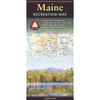
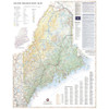
From the summit of Mount Katahdin, rising above the vast North Woods, to the rocky shores of Mount Desert Island, this folded map showcases Maine’s unique geography in gorgeous detail. The map side covers the entire state with extensive highway road detail, points of interest, public land boundaries, and elevation tints overlaid on beautiful shaded relief. The reverse side features categorized recreation listings for parks, forests, campgrounds, fishing spots, and more, along with a dedicated map and guide for Acadia National Park.
- Highway road detail
- Points of interest
- Public land boundaries
- Elevation tints overlaid on beautiful shaded relief.
- Parks, forests, campgrounds, fishing spots, and more
- Dedicated map and guide for Acadia National Park.
- Scale: 1:190,080
- Folded dimensions: 4" x 9"
- Flat dimensions: 38.25" x 27"
ISBN: 9780783499802


