Images

National Geographic Franconia Notch, Lincoln Trails Illustrated Map zoom in
×

Promotions

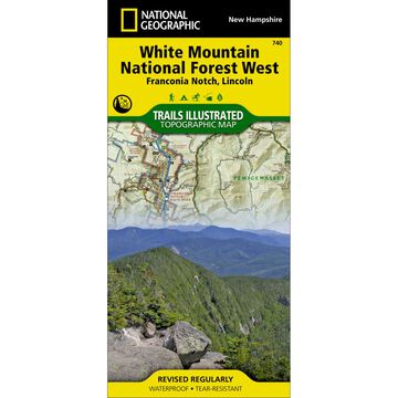
National Geographic Franconia Notch, Lincoln Trails Illustrated Map

This Trails Illustrated topographic map is a comprehensive and complete recreational map for the White Mountains of New Hampshire (Lincoln, Franconia Notch).
 
The map shows all trails, campsites, and recreational features, plus valuable wilderness and Leave No Trace guidelines. A full UTM grid is printed on the map to aid with GPS navigation.
 
Coverage area includes:

  • White Mountain National Forest
  • Pemigewasset and Sandwich Range wilderness areas
  • Appalachian National Scenic Trail from Hanover, NH to Crawford Notch State Park
  • Franconia Notch and Echo Lake state parks
  • Kancamagus Highway
  • Tripoli Road
  • Bear Notch Road
  • Also includes Plymouth, Rumney, Lincoln, Twin Mountain, North Conway and Wonalancet


All data is updated to reflect road closings, new trails, and campground relocation. Printed on waterproof, tear-resistant material with a plastic coating that offers supreme durability for your next outdoor adventure.

  • Approx. 4-1/4" x 9-1/4" folded
  • Approx. 25-1/2" x 37-3/4" fully opened
  • Scale = 1:70,000


ISBN: 9781566954655

More »

Maps have been a cornerstone of National Geographic® since they were published in the first issue of the magazine, in October 1888. The year 1915 witnessed the founding of the Map Department, which evolved into today’s National Geographic Maps®.

Whether you're dreaming of places, planning a holiday or hike, or learning about the world, National Geopgraphic® offers hundres of Travel, Trail and Wall maps to guide your exploration.

Description Price Qty

740

More Info
$14.95